
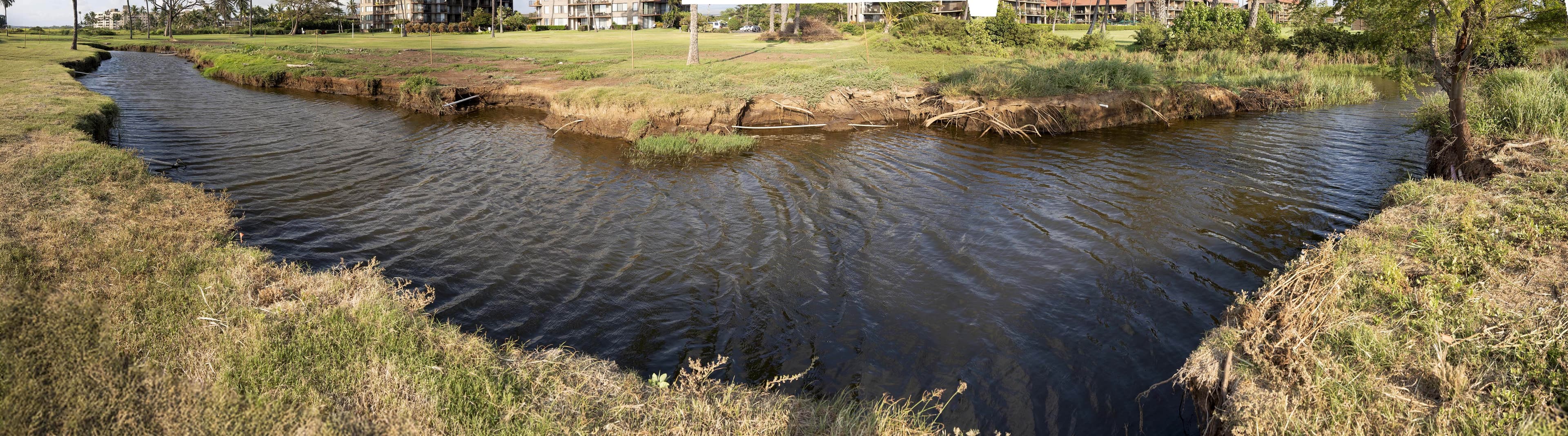
When the Kona Low storm hit (March 10–16, 2026), the water did what water does: it found the old muliwai. Over time, layers of sediment had been laid down here and covered with non-native grasses. Those unstructured fine sediments, held only by the shallow roots of non-native grasses, could not stabilize the soil. The flood back-cut through them like a plunge-pool waterfall, from the central Waiohuli site to Waipuilani, and opened up a gash that exposed a new muliwai. We documented it as it happened — from the air during the flood, on the ground in the days after, and with a point-cloud survey against our 2025 baseline. This is kilo at its most direct: the ʻāina showing us where the water wants to go.
From the air, during the flood
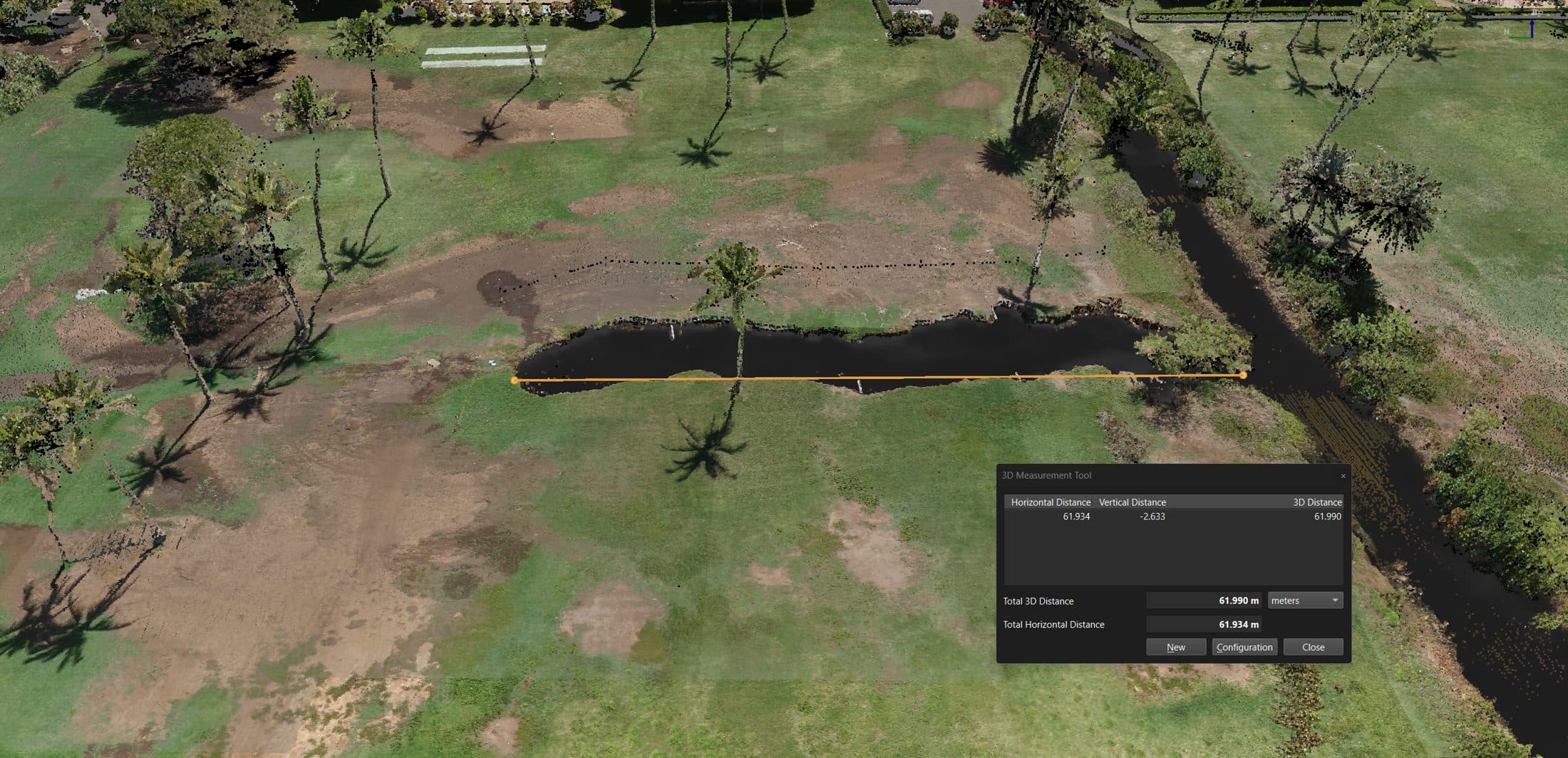
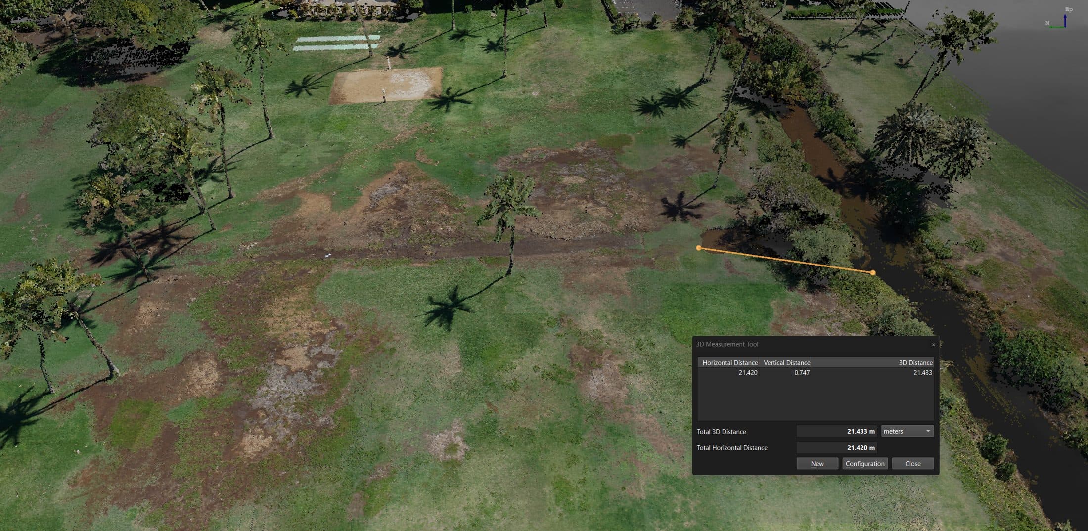
Measured: 2025 to 2026
Point-cloud surveys of the same ground, one year apart. Drag the handle to compare. The channel and wetland footprint grew by roughly forty meters where the flood reopened the muliwai.
On the ground, in the days after
“Slow it, spread it, sink it.” The storm did in a few days what our restoration is designed to invite over years — and it showed us exactly where the wetland wants to be.