

Connected Landscapes: Mauka to Makai
From the living reef up to the high ridges of Maui, we work across an interconnected ecological continuum.
Our work is not confined to property lines or arbitrary zoning. We care for connected land and sea systems—coastal dunes, wetlands, estuaries, and nearshore fisheries.
By restoring natural pathways and ecological function across specific place anchors, we demonstrate how community-led stewardship can safeguard our shoreline, filter land-based runoff, and revitalize our living coral reefs.
A Living Map of Restoration
The Waiohuli Kai region is an active wetland and dune system in Kīhei, Maui. Historically, this area held and filtered water on land before it reached the ocean, protecting the nearshore reef.
Select a place below to explore our specific restoration goals, challenges, and current work.
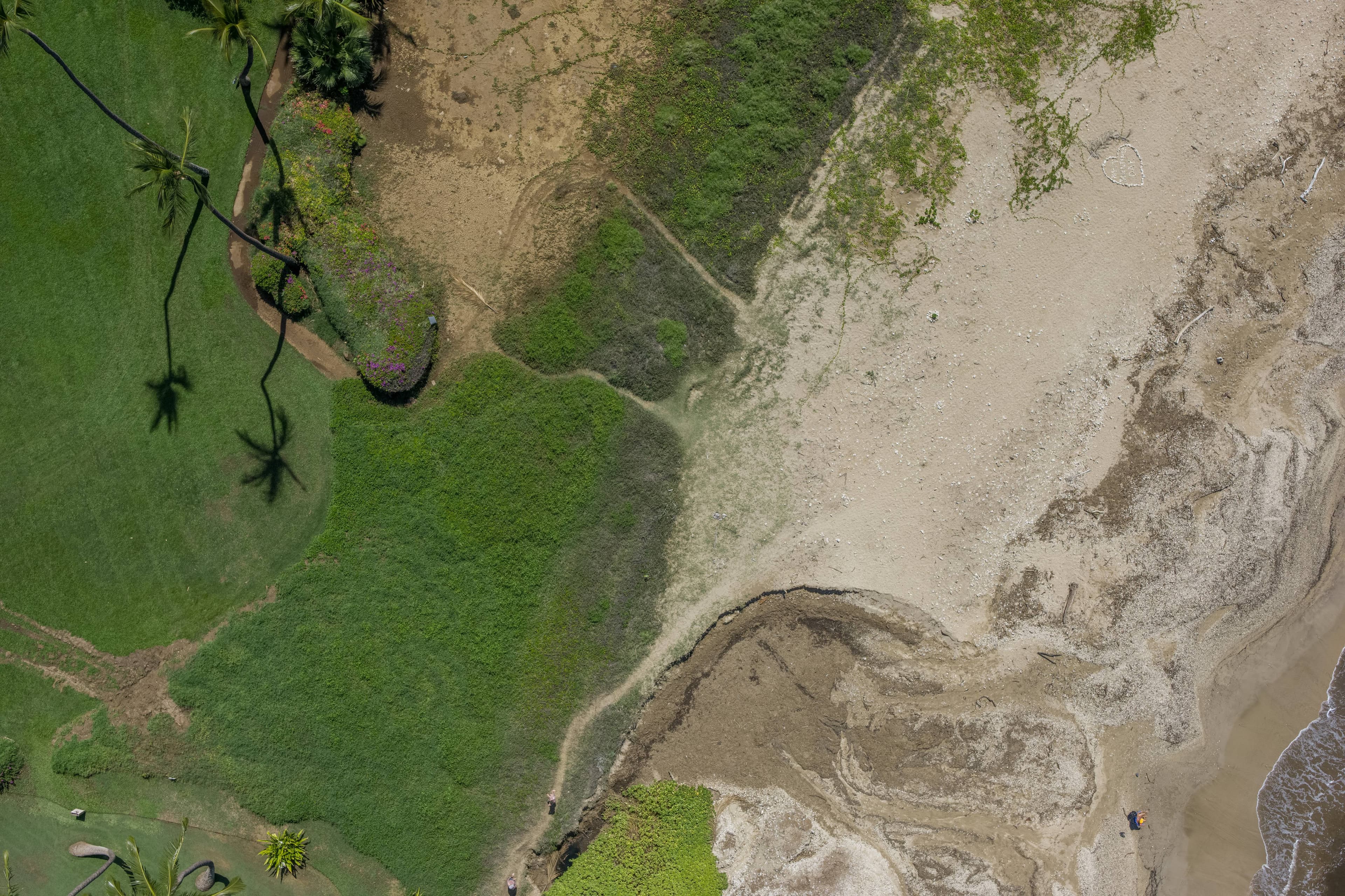
Where the muliwai meets the sea — and the work begins.
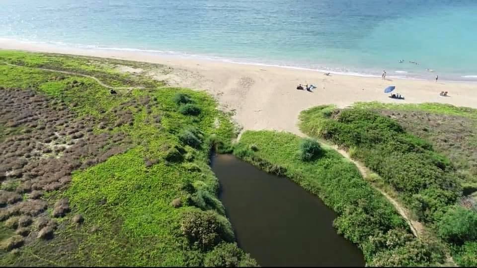
The Core Preserve: Restoring Coastal Wet-Lands & Dune Buffers
Waiohuli Kai is the primary, active preserve where ʻĀinakūkoʻa is executing on-the-ground restoration. This coastal site is a critical intersection where fresh water, sand dunes, and the marine environment meet. Once a highly functioning wetland and estuarine system, this site is now being stabilized to protect the inland environment and the living coral reef just offshore.
Restoration Goals
- Dune Stabilization: Utilizing native beach-dune plants (sedge, beach morning glory, naupaka) to bind sand and build natural barriers against sea-level rise and storm surges.
- Wetland Filtration: Re-establishing native marsh vegetation to naturalize water-holding capacity, creating a living filter that traps sediment before it reaches the sea.
- Native Seed Bank Protection: Actively weeding invasive plants to allow the dormant native seed bank to naturally regenerate.
Challenges
- Shoreline Erosion: Severe coastal erosion caused by historic sand mining and coastal development.
- Disrupted Hydrology: Legacy civil engineering (including South Kihei Road) that channelizes and concentrates stormwater instead of allowing it to naturally slow, spread, and sink.
- Invasive Species Pressures: High density of aggressive weeds (such as pickleweed and buffelgrass) that choke out native flora.
Current Work & Science Integration
Active weeding, dune molding, and native outplanting. Integrating high-precision hydrology and elevation mapping to track how water flows across the site during high-rain events.
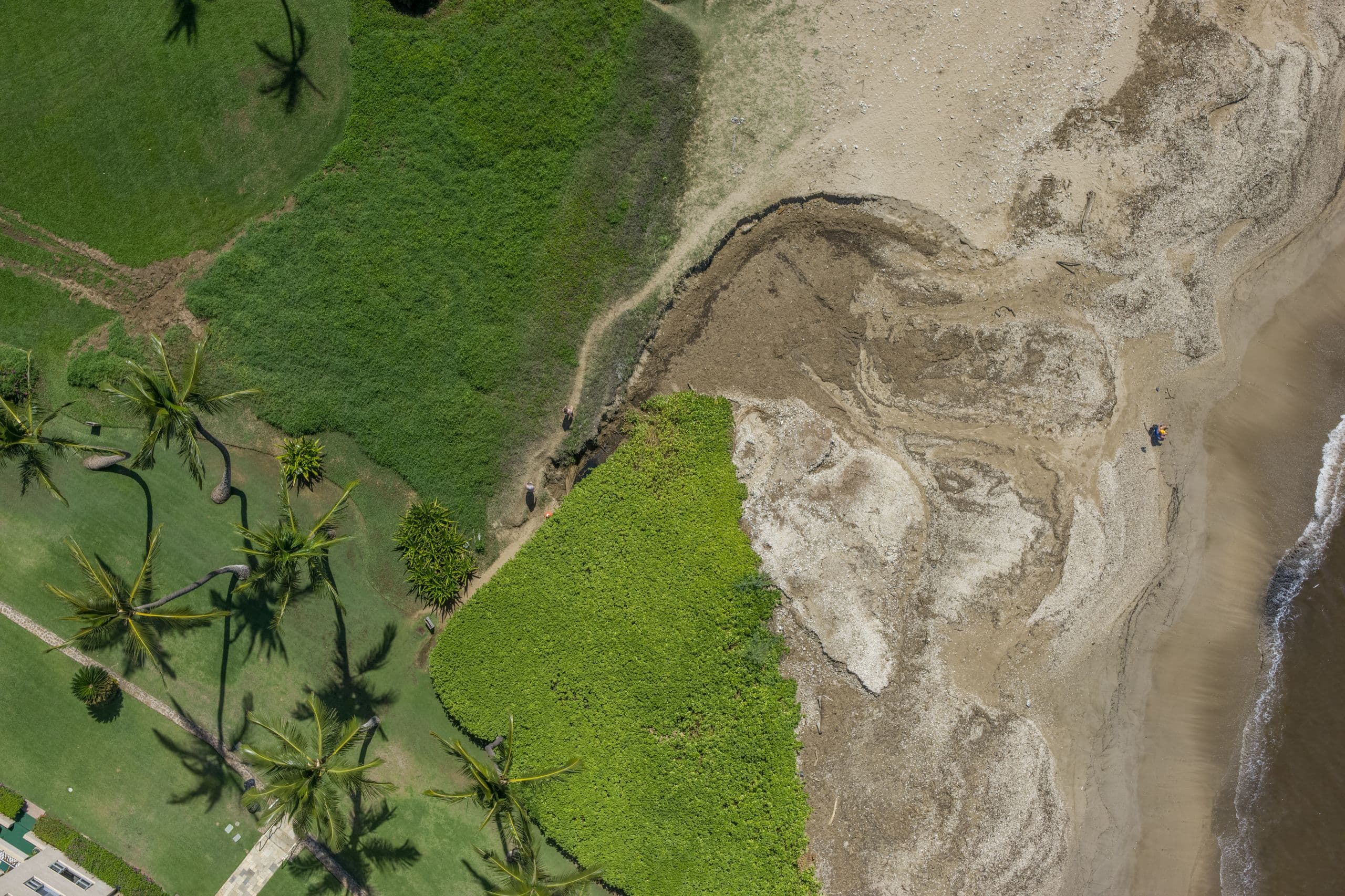
Kahale Koʻa: A Gathering Place for Culture & Ecology
North Waiohuli, historically known in part around Kahale Koʻa (Kahalia Papa, Kahaleola), represents the cultural heart and meeting place of the Waiohuli shoreline. This site serves as a vital bridge between land-based cultural practice and ocean-based stewardship. Here, we observe how community relationships and the natural environment interlace.
Restoration Goals
- Cultural Gathering Space: Re-establishing Kahale Koʻa as a traditional meeting place for practitioners, educators, and community members.
- Estuarine Restoration: Rehabilitating the historic calm water lagoon to support native brackish species and traditional gathering.
- Community Education: Creating hands-on spaces for intergenerational learning, net-throwing, and traditional fishing workshops.
Challenges
- Fragmented Ownership: Complex land management boundaries across state, county, and private parcels.
- Siltation: Legacy upland sediment runoff settling in the lagoon, degrading water quality and depth.
Current Work & Science Integration
Collaborative planning with stakeholders, cultural practitioners, and community groups. Baseline ecological and topographical mapping to understand historic water flow.
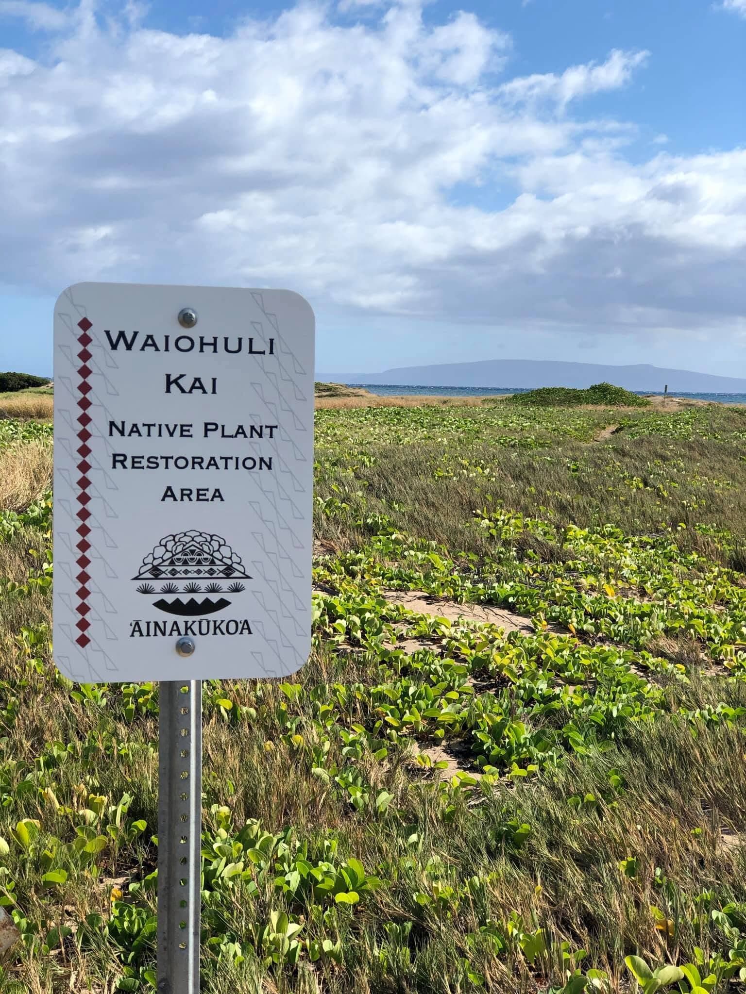
Long-Term Observation & Dune Transects
South Waiohuli Kai is an area designated for continued long-term observation, baseline data gathering, and future phased restoration. This zone is highly connected to adjacent residential areas and resorts, making it a critical interface for community education and managing human impacts on the dunes.
Restoration Goals
- Dune Protection: Establishing clear, designated footpaths to mitigate pedestrian damage to fragile dune vegetation.
- Invasive Containment: Creating buffer zones to prevent aggressive invasive weeds from encroaching on restored native areas in the main preserve.
- Active Kilo Monitoring: Running seasonal observation transects to track bird migrations, marine life indicators, and coastal shifts.
Challenges
- High Recreational Foot Traffic: Unregulated pathways crossing the dunes, leading to sand destabilization and vegetation loss.
- Urban Runoff: Point-source storm drains introducing untreated street runoff directly into the nearshore environment.
Current Work & Science Integration
Community outreach to adjacent condo owners and visitors to encourage dune-conscious behavior. Continuous drone-based aerial change detection and baseline topographical monitoring.
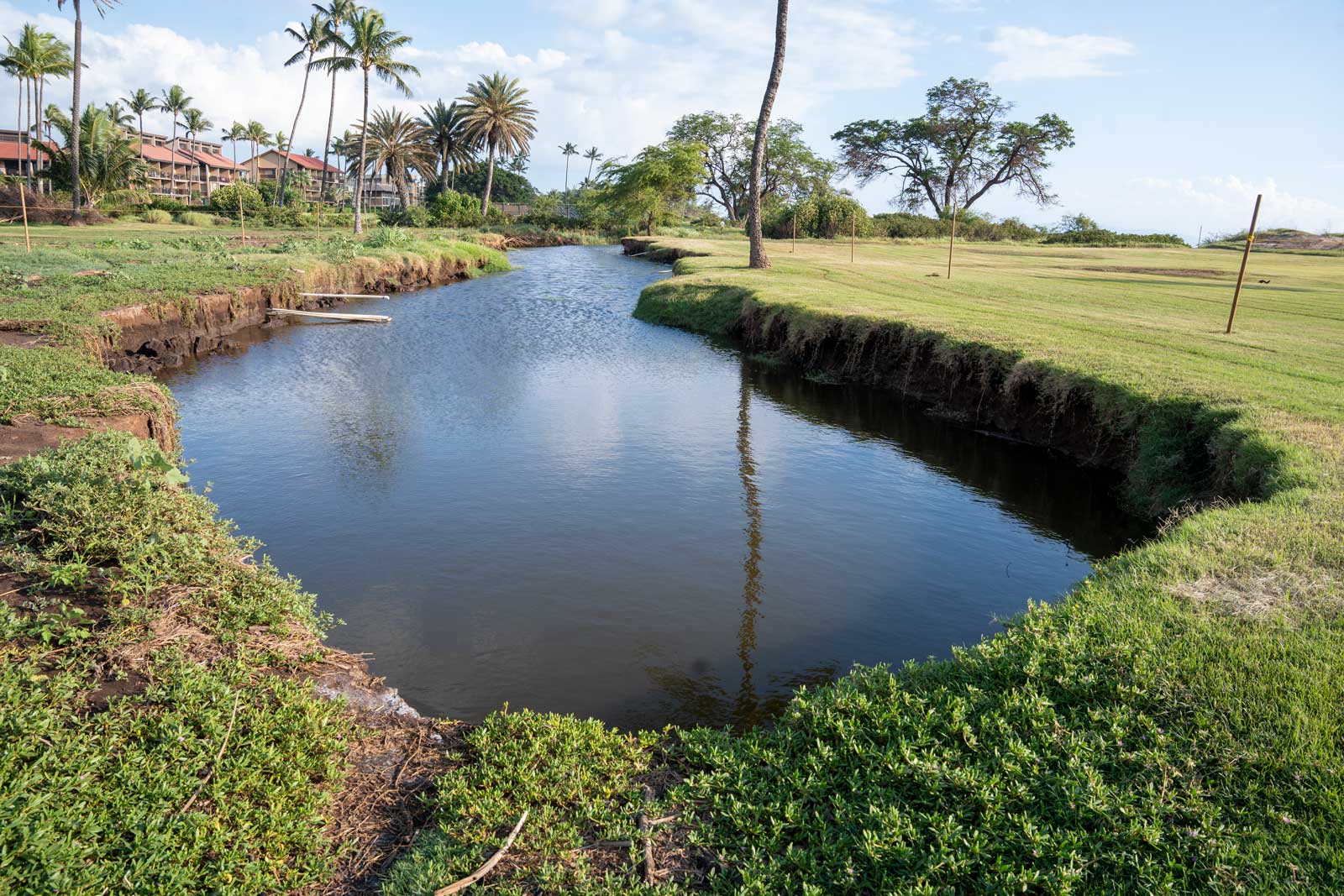
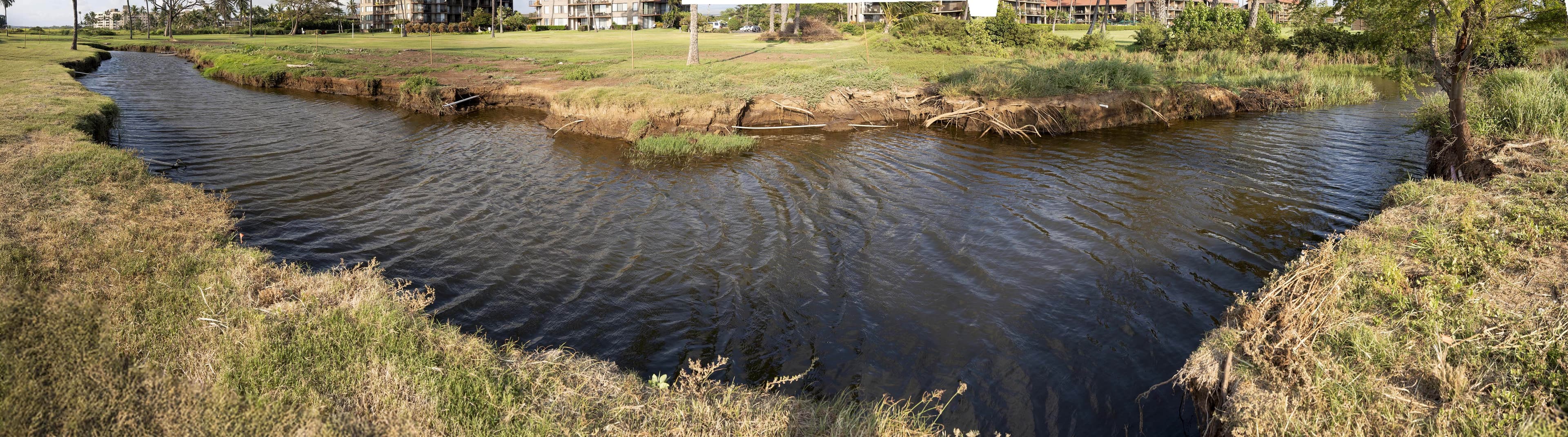
Waipuilani: Restoring the Natural Estuary (Muliwai)
Waipuilani represents a critical opportunity for the natural expansion and restoration of the muliwai (estuary/river mouth) system. In traditional Hawaiian land management, the muliwai is a sacred ecological nursery where upland stream waters mix with the ocean, creating a nutrient-rich, brackish buffer zone that supports diverse fish populations and native limu (seaweed).
Restoration Goals
- Muliwai Expansion: Allowing brackish waters to naturally expand and flow across designated low-lying areas during heavy rain, preventing residential flooding while nourishing the estuary.
- Limu Habitat Support: Restoring the clean, brackish water flows required to sustain native limu beds just offshore.
- Wetland Sedge Recruitment: Outplanting native sedges (like makaloa) to anchor the estuarine banks and filter organic nutrients.
Challenges
- Urban Encroachment: The estuary is heavily constrained by surrounding storm infrastructure, commercial parcels, and roads.
- Water Quality Degradation: High organic nutrient loads from urban runoff leading to eutrophication and hypoxia.
Current Work & Science Integration
Geospatial water flow modeling to simulate flood-reduction strategies using nature-based infrastructure. Regular water quality monitoring (salinity, temperature, dissolved oxygen) to track estuarine health.
Science-Driven Restoration: The Geospatial Foundation
Our on-the-ground restoration is guided by rigorous geospatial science, data collection, and processing. Since 2023, Levity Creations has served as ʻĀinakūkoʻa’s primary technical partner, providing advanced spatial intelligence, high-resolution mapping, and scientific visualizations.
By integrating cultural Kilo practices with high-precision modern data, we make informed land-management decisions that support natural systems rather than trying to control them.
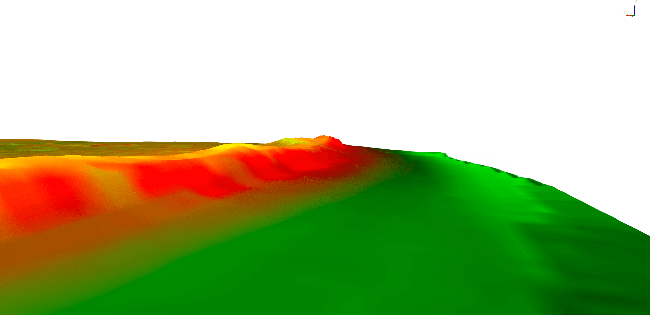
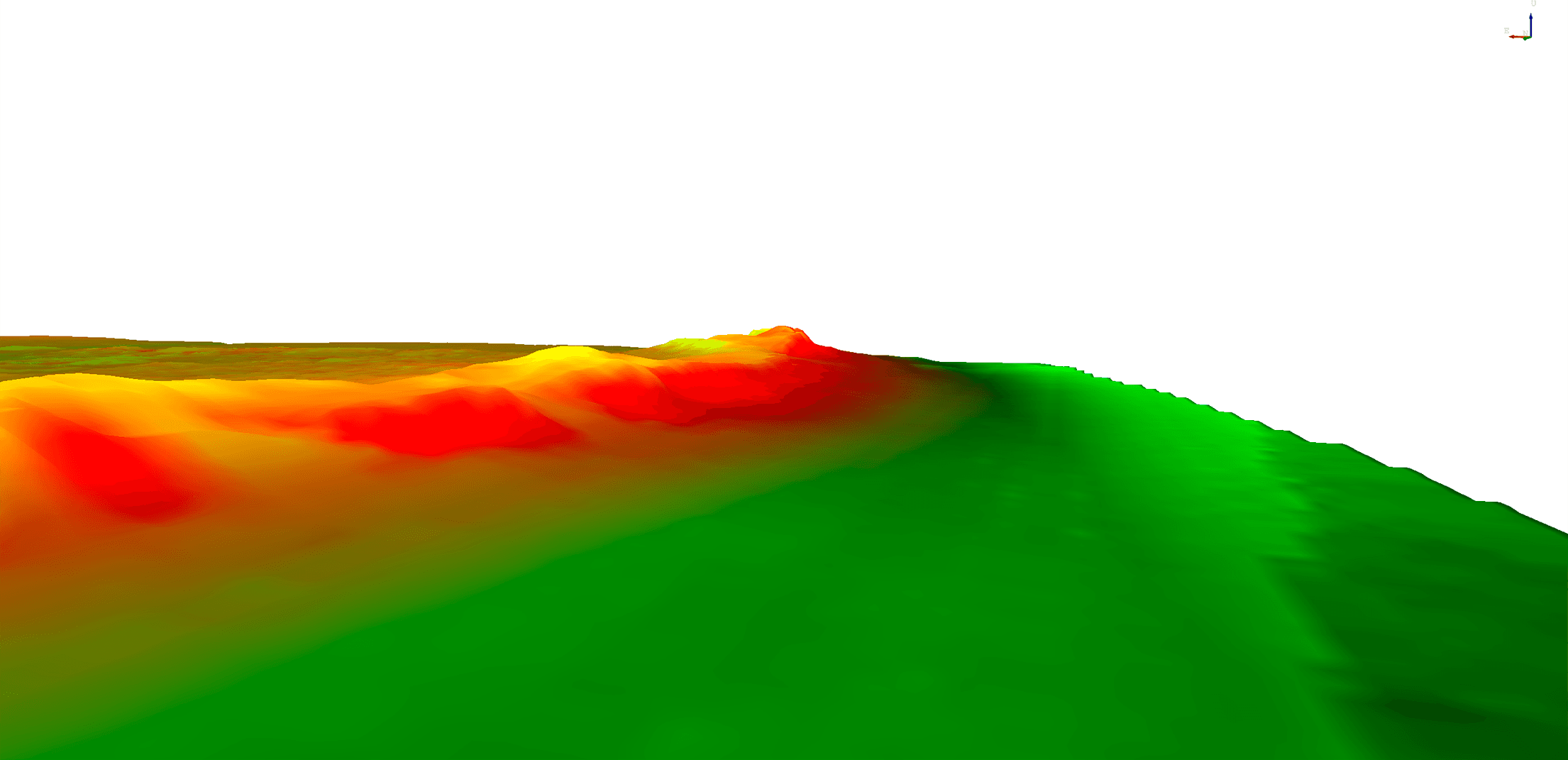
Waiohuli Kai dunes, 2025 to 2026. Drag the handle to compare.
LiDAR & Elevation Mapping
High-resolution LiDAR penetrative mapping to chart exact topographical contours and hidden water pathways.
Hydrological Flow Simulations
Custom water flow modeling used to design flood-mitigation strategies that slow, spread, and sink water.
High-Res Orthomosaics
Centimeter-accurate aerial mapping to establish ecological baselines and plan precise restoration zones.
Temporal Change Detection
Multi-year aerial imagery comparisons capturing the dynamic response of the dunes and wetlands over time.
Restoration in Action
See the transformative power of community stewardship, from clearing invasive brush to outplanting native species and observing our thriving wildlife.
Lend Your Hands to the Land
We invite partners, neighbors, and volunteers to take part in our place-based restoration efforts. Whether you're pulling weeds, mapping data, or learning Kilo, your work matters.